Article Surah 89 · Ayah 3
THE PEOPLE OF AL-HIJR
THE PEOPLE OF AL-HIJR
The people of Thamud are a tribe mentioned in the Qur'an about whom a substantial amount is known. Historical sources confirm that a people known as the Thamud existed many years ago. It is believed that the people of al-Hijr referred to in the Qur'an are actually the same people as Thamud, because another name for Thamud is "Ashab al-Hijr." That being the case, the word "Thamud" may be the name of a people and al-Hijr one of the cities they founded. In fact, this is exactly what is suggested by the descriptions of the Greek geographer Pliny, who wrote that Thamud lived in places called Domotha and Hegra, the present-day city of Hijr.236
The oldest known historical source to refer to Thamud are the Babylonian state records. They relate the details of the victory of King Sargon II of Babylon over that people in the 8th century B.C. Sargon defeated them in a war in Northern Arabia. The Greeks also mention this people and Aristotle, Ptolemy and Pliny refer to them as the "Thamudaei" i.e. "Thamud."237 All trace of them vanished before the time of our Prophet (saas) in around 400-600.
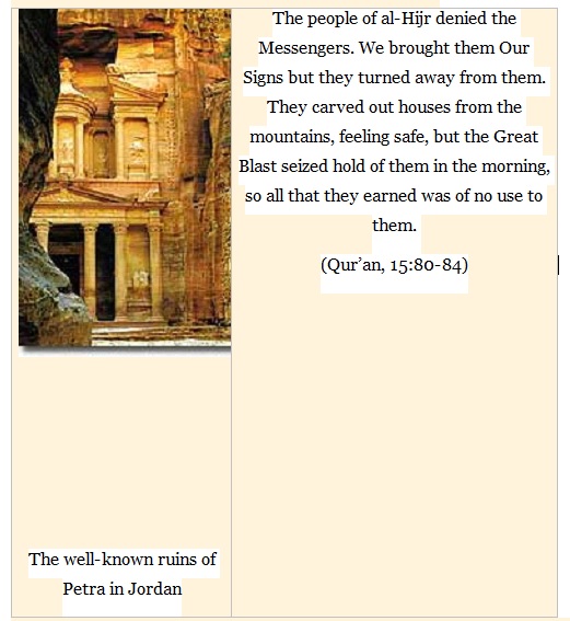
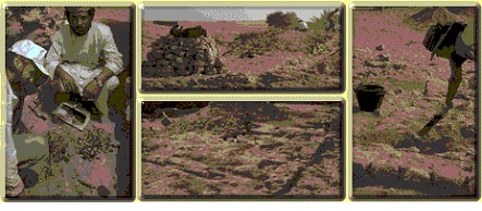
Today, one can see the finest examples of these peoples' stonework in the Rum Valley in Jordan, better known as Petra. Indeed, the Qur'an refers to their expertise in stonework thus:
[Salih said to his people,] "Remember when He appointed you successors to 'Ad and settled you in the land. You built palaces on its plains and carved out houses from the mountains. Remember Allah's blessings and do not go about the earth, corrupting it." (Qur'an, 7:74)
The people of al-Hijr denied the Messengers. We brought them Our Signs but they turned away from them. They carved out houses from the mountains, feeling safe, but the Great Blast seized hold of them in the morning, so all that they earned was of no use to them. (Qur'an, 15:80-84)
NASA OBSERVATION
Ubar -- The Lost City
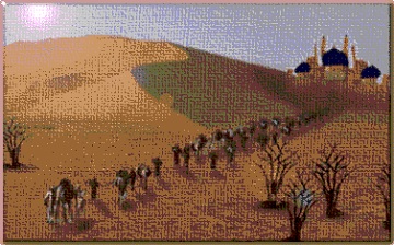
From ancient accounts, the basis for Ubar's existence was frankincense, a sweet smelling incense then as valuable as gold. It was used as a fragrance, for medicinal purposes, and for embalming. The frankincense was prepared from the gum or sap of trees grown in the nearby Qara mountains. From there it was transported by camel caravan to the world centers of Alexandria, Jerusalem, and Damascus, and beyond to the western Mediterranean. Ubar became enormously rich from this trade in frankincense. What started as a small town around an oasis became a walled city of great renown.
Then, according to legend, great wickedness flourished in Ubar, and the Almighty Allah destroyed the fortress city and blotted out the roads that led to it. Ubar was lost for thousands of years, perhaps buried under the shifting sands of the desert of the Arabian peninsula. T. E. Lawrence (Lawrence of Arabia) called it the "Atlantis of the sands," but he died before he could lead his own expedition to find it.
Looking For Ubar
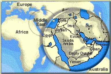
The question with Ubar was where exactly to look. It was thought to be in or near the Rub' al Khali (Empty Quarter), a great sand sea in the southern Arabian Peninsula. This very arid area is roughly the size of Texas with sand dunes over 600 feet high. Searching such a vast area was a considerable challenge.
In the early 1980s a Los Angeles filmmaker and archaeological enthusiast named Nicholas Clapp began researching the history of Ubar and planning an archaeological expedition. George Hedges, an attorney, provided the organizational expertise and carried out most of the logistics. Clapp used ancient maps, literature, and records to arrive at a general location for Ubar in southern Oman. This was still a dauntingly large area to search
Remote Sensing To the Rescue
Clapp decided to enlist NASA's help because of its expertise in applying remote sensing. He contacted Dr. Ronald Blom of NASA's Jet Propulsion Laboratory for help. Data from an experiment on the NASA space shuttle using imaging radar was of particular interest. This experiment bounced radar off the Earth's surface to determine the type of terrain. Since the radar penetrated through dry sand, they thought the remains of a buried fortress might be revealed.
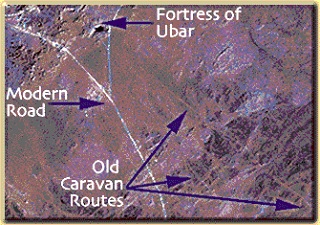
The initial radar images yielded no direct indication of the location of the site, but images from the Landsat and SPOT remote sensing satellites showed distinct tracks through the desert. The researchers identified these tracks as old caravan routes. The caravan routes converged at a place called Ash Shisr, near the eastern edge of the Empty Quarter.
Two expeditions to Oman were mounted; one in 1990 and one in 1991. The expedition team included Nicholas Clapp, Dr. Ronald Blom, archaeologist Dr. Juris Zarins, and British explorer Sir Ranulph Fiennes, who had been on previous Ubar searches. The team investigated the area around Ash Shisr, and soon an archaeological excavation began.
Exavation
The excavations uncovered a large octagonal fortress with thick walls ten feet high and eight tall towers at the corners. The archaeologists also found Greek, Roman, and Syrian pottery, the oldest of which was dated at more than 4,000 years old. The discovery of these types of artifacts from far away places indicated that this was indeed a major center for trade and likely the fabled Ubar.
One startling result of the excavation was that it appears that Ubar did meet with a catastrophic end, as many of the legends describe. The excavation revealed a giant limestone cavern beneath the fortress. The scientists believe that Ubar may have been destroyed when a large portion of it collapsed into the cavern.
There is still much to be discovered at the site and many questions remain. What is certain is that Mr. Clapp and his team took ancient stories and modern technology and from them wrung a significant archaeological discovery.
The Technology Behind the Search
The search for Ubar is a good example of how remote sensing can be used with a more traditional discipline like archaeology. Radar imaging is one of the most important types of remote sensing in arid regions and it is has seen wide application in archaeology. In the search for Ubar, however, the limited coverage provided by the space shuttle-based imaging radar necessitated the use of other remotely sensed data.
Landsat imagery played a very important role in the search for Ubar. Using a sensor known as the Thematic Mapper, Landsat produced images that the team could use to identify features like surface tracks. Landsat imagery covers a large area in a single scene, over 30,000 square kilometers, allowing the team to analyze vast portions of the desert at one time.
Data from the French satellite known as SPOT were also used. The SPOT data provide the most detailed, or highest resolution, images available to the team.
The researchers used these and other data in their search. Sophisticated image processing techniques were used to highlight the important features. Data from different sources were combined to yield more clues. The result was that the expedition was able to exclude large regions of the desert from consideration, and narrow the search to the most promising sites